
Intro
India Smart Map Census 2027 marks a transformative leap in the nation’s approach to population data, introducing advanced digital mapping and geo-tagging for every household. This milestone project matters because it will redefine governance, help with disaster management, and empower local planning across the country.
Key Points
- First-ever nationwide digital mapping of all Indian households
- Use of geo-tagging and GIS for enhanced census accuracy
- Expected benefits for governance, emergency response, and city planning
- Major upgrade over previous census technology and methods
- Rollout starts with mock drills, promising strong practical impact
Table of Contents
The Vision Behind India Smart Map Census 2027
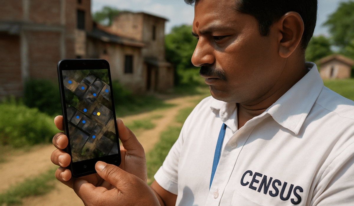
India Smart Map Census 2027 is underway as the world’s largest administrative mapping project, covering every household with a digital dot on national maps. Enumerators will use digital technology and smartphones to geo-tag properties, ensuring more accurate population data for policies and resource allocation.
Digital Census Mapping: How It Works
This census uses digital mapping tools and GIS (Geographic Information Systems) to plot every home on a digital map in real time. Each property receives a “digital dot,” which improves traceability, data collection, and analysis. This process strengthens policymaking by providing more granular, location-based insights.
Key Benefits of Geo-Tagging Census Data
Geo-tagging brings critical benefits for government and citizens alike.
- Enables targeted resource allocation and helps bridge regional gaps
- Supports disaster management by making real-time rescue and relief operations easier
- Strengthens local planning with precise urban and rural data
Smart City Planning Powered by Census Data
Smart City initiatives will receive a major boost thanks to detailed census maps. Planning for infrastructure, health, transport, and education can be streamlined using the new digital census layer, driving better outcomes for urban development.
How Census Mapping Helps Governance
With more accurate, household-level data, governments can plan welfare schemes, target populations precisely, and monitor implementation more effectively. This digital transformation promises to reduce leakages and strengthen transparency in resource distribution.
Data Privacy in Digital Census
Data privacy will be overseen with robust security and encryption protocols. Authorities have committed to upholding privacy standards as they collect and store sensitive, geo-tagged data, balancing the public good and individual rights.
If you’re curious about when exactly the service will go live and what it will cost, don’t miss our detailed article on Elon Musk’s Starlink launch in India 2025
Disaster Management Census Map
Emergency response will be future-ready with instant access to digital map data for every location. This allows authorities to identify affected areas, track resources, and deliver help swiftly, improving safety during natural disasters.
Freshness Layer Elements
- Year-on-Year Comparison: India’s traditional paper-based census shifts to digital mapping for the first time since independence, marking a milestone year.
- Local/Regional Impact: Digital dots on each home enable direct, region-specific planning, especially for remote and underserved areas.
- User-Centric Insight: Citizens benefit through improved targeting for benefits schemes, faster response times, and smarter urban upgrades.
- Expert/Official Angle: Government officials and planners highlight data reliability, better infrastructure decisions, and potential for transparent scheme delivery.
- Past Trends: Previous censuses relied on manual counting and paperwork, often causing delays and inaccuracies—2027 will address these issues.
Conclusion
India Smart Map Census 2027 is set to revolutionize data collection and governance with digital mapping and geo-tagging, offering wide-reaching benefits for citizens, disaster management, and Smart City planning.
FAQs for India Smart Map Census 2027
Q1. What is India Smart Map Census 2027?
A: It is the country’s first-ever fully digital census, using mapping and geo-tagging technology to record data with unprecedented accuracy.
Q2. How does geo-tagging benefit citizens?
A: Geo-tagging ensures every household is counted, improving the delivery of public services, disaster relief, and welfare schemes.
Q3. Will the new census improve data privacy?
A: Authorities promise stringent privacy and security measures to protect sensitive information during the digital census process.
Q4. How does this census help Smart City planning?
A: Digital mapping gives planners detailed location data, helping them make better decisions for roads, hospitals, transport, and other public works.


November 20, 2025